
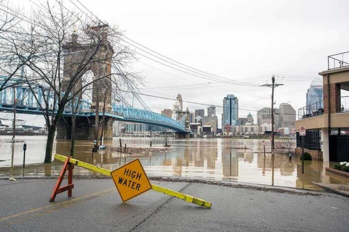
What made this nor’easter so punishing wasn’t a single deluge or one apocalyptic tide; it was the relentless stacking of hazards — persistent onshore winds, multiple high-tide cycles, saturated soils, and long-duration surf — that turned familiar waterfronts and low-lying blocks into floodplains and sent trees crashing across streets and playgrounds.
At a Glance
- City officials issued a multiday travel advisory and emergency guidance before the worst conditions, flagging rain, strong winds, and coastal flooding windows tied to high tides.
- Coastal flood alerts spanned the Mid-Atlantic to New England; streets in parts of New York City and New Jersey went underwater as onshore winds coincided with high tides.
- Tree damage was extensive; NYC Parks worked 12-hour shifts and logged roughly a thousand-plus service requests for damaged or fallen trees by the storm’s peak.
- Governor Kathy Hochul declared a State of Emergency for New York City, Long Island, and Westchester as utilities, transit, and event organizers braced for disruptions.
What happened: a compound coastal event, forecast and then realized
New York City entered the weekend with clear signals from emergency managers: this would be a coastal, wind-driven storm with the highest risks bracketing the high-tide cycles. The Mayor’s Office and NYC Emergency Management issued a travel advisory through the weekend, emphasizing rain, strong northeast winds, and coastal flooding — and specifically timing the most dangerous windows to Friday evening and Saturday morning tides. As the nor’easter matured along the coast, those forecasts were validated. Coastal flood alerts stretched from Virginia through southern Maine; in New York and New Jersey, streets in low-lying neighborhoods flooded where onshore winds pushed water into bays and back-bay inlets during high tide. This was the classic nor’easter hazard profile, not a flash-inland rain catastrophe but a prolonged marine push coupled with heavy surf and periodic rain bands.
By Saturday into Sunday, “duration” became the defining feature. The New York Times’ live coverage noted low-lying neighborhoods submerged and power knocked out for thousands as persistent winds and unusually high tides stacked impacts across cycles, forcing major event cancellations and widespread travel headaches. State officials focused their warnings on coastal flooding, with Governor Hochul emphasizing heavy rain, powerful winds, and waves peaking well into the teens and higher offshore, consistent with the long-fetch northeast wind field characteristic of these systems.
Trees down, power lines compromised, and a round-the-clock municipal response
While the visible drama centered on seawater overtopping bulkheads and submerging cars, the day-to-day hazard for most New Yorkers arrived from above, not below. Sustained winds and saturated root zones brought down trees in every borough. NYC Parks moved to 12-hour shifts, a posture reserved for multi-day, citywide incidents, and the Downed Tree Task Force quickly accumulated well over a thousand service requests — hundreds for trees fully down — even with the usual duplication in reporting during major storms. Utilities worked in parallel to triage downed wires and restore service, while transportation agencies adjusted operations around the most flood-prone rail segments and roadways.
This pattern — coastal flooding at the edges, tree and power infrastructure in the interior — is archetypal for nor’easters. Prolonged gale-force gusts, rather than hurricane-like peak winds, fatigue canopies and weaken marginal branches across hours and days. Add soaked soils and each subsequent squall line has a better chance of toppling an already-stressed tree. The city’s playbook reflects that reality: arborist crews, forestry vendors on call, coordination through the task force, and public channels steering residents to 311 for non-emergencies and 911 for active hazards — precisely what agencies reinforced throughout the weekend.
Why the flooding looked “worst since Sandy” in some places — and why that phrase is tricky
In every major coastal storm, someone will call their neighborhood scene the worst since Sandy. Sometimes they are right at a block scale; sometimes the comparison overgeneralizes from a vivid local image. The mechanism here matters. Nor’easters drive water into estuaries and back bays repeatedly, so each high tide can ride in higher atop residual water that never fully drained — especially when persistent winds maintain setup against the coast. That dynamic, amplified by a full moon tide in this case, can yield “highest in years” visuals on a specific street even when citywide peaks fall short of historic benchmarks. Early coverage, by necessity, leans on what can be observed and managed in real time — alerts, rescues, closures — while the authoritative accounting of the storm’s place in the record arrives later from tide gauges, loss estimates, and after-action reviews.
New York’s scholarly and operational history with nor’easters explains the plausibility of major, repeated flooding without tropical-storm headlines. Decades of analysis document frequent minor and moderate surge events in the harbor and back bays; the celebrated December 1992 nor’easter remains a reference point for extreme non-tropical coastal flooding in the region. In short, this storm’s impact pattern — sustained onshore winds, multiple high-water cycles, notable local maxima in back-bay neighborhoods — fits a well-understood mold. Sorting out whether “worst since Sandy” applies citywide, neighborhood-wide, or merely at the corners everyone films, is a separate analytical step that follows the response, not something responders can settle mid-storm.
Preparation and protective posture: what worked, and where the risks concentrate
Officials did what the hazard demanded: declare emergencies to free resources and attention; warn residents off roads and shorelines; surge forestry, sanitation, and utility crews; and tailor transit operations to known flood pinch points. Governor Hochul’s State of Emergency for New York City, Long Island, and Westchester framed the weekend for what it was — a coastal-flooding, power, and travel-disruption event with embedded wind hazards — and matched the city’s advisory cadence. Event cancellations and ferry suspensions were not overreactions; they were prudent choices in an environment where 15–20-foot offshore waves and strong rip currents made even routine shoreline activity risky.
The geographic pattern of impact was unsurprising. South-shore Long Island communities, Jamaica Bay’s fringe, and similar back-bay neighborhoods in New Jersey faced the brunt of tidal flooding. Interior boroughs, shielded from surge, experienced the more familiar nor’easter signature: downed limbs, snapped lines, and scattered outages. This spatial differentiation — water where the ocean backs up, wind damage where trees and wires are dense — is why coastal warnings and inland wind advisories often coexist, and why messaging rightly emphasized both.
How to read the next nor’easter — and prepare accordingly
Two lessons hold for every future coastal system. First, time your decisions to the tides. Coastal flooding in nor’easters is tidal-cycle dependent; the “same” storm will be tangibly worse at the morning high tide after a night of onshore winds than at a mid-afternoon low tide with a modest wind lull. When officials highlight specific tide windows, they are giving you the storm’s schedule — heed it. Second, think in terms of duration, not just intensity. A moderate gale that persists for 36–48 hours, with heavy surf and full-moon tides, can rival the practical disruption of a shorter, “stronger” blow.
For homeowners and building managers in low-lying areas, that means elevating utilities where possible, checking backflow prevention, staging flood barriers ahead of the first high-water cycle, and moving vehicles to higher ground before roads are cut. For everyone else, it’s simpler: avoid driving into ponded water, stay clear of parks and street trees during peak gusts, and reserve 911 for life-safety hazards while using 311 to report non-emergency damage so crews can prioritize. Those are not mere guidelines; they are part of the city’s incident rhythm, allowing limited field teams to work the highest-risk problems first.
US Nor Easter Live updates via New York Times: High winds and exceptionally high tides 🌊caused flooding ⚠️in low-lying areas along Jersey Shore and in some coastal parts of NYC🗽, submerging streets, cars and first floors of some buildings. https://t.co/PagvTDyUrU #climate #News pic.twitter.com/P6CHGQ2usR
— EnviroEdgeNews (@EnviroEdgeNews) September 26, 2026
The bottom line
This nor’easter delivered exactly the profile meteorologists and emergency managers warned about: persistent onshore winds, repeated high-tide flooding in vulnerable neighborhoods, widespread tree damage, and a multi-day response posture. The strongest claims about “worst since Sandy” will be clarified by the record — tide gauges, claims data, after-action reviews — but none of that undermines what residents experienced block by block. In a city built on estuaries and barrier edges, nor’easters remain a defining hazard. The smartest response is the one we saw: match posture to tides and wind, protect people first, and let the longer accounting come after the water recedes.
Sources:
nypost.com, nyc.gov, abcnews.com, cbsnews.com, abc7ny.com, nytimes.com, brooklyn.news12.com, x.com, longisland.news12.com, bronx.news12.com