
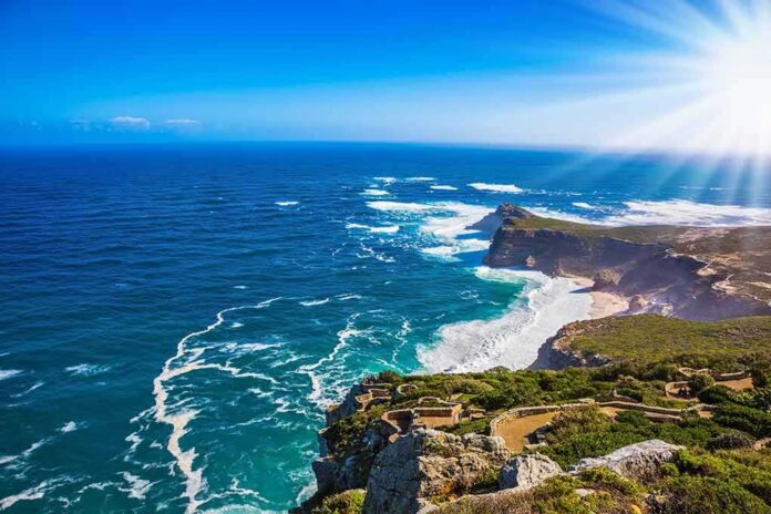
A dramatic surface crack on the coastal bluff above the Salt Creek Point trail below The Ritz-Carlton, Laguna Niguel is not just a viral image; it is an object lesson in how Southern California’s sea cliffs fail—episodically, often after storms, through a mix of rainfall infiltration from above and wave attack from below.
At a Glance
- A pronounced fissure has opened in the bluff above the heavily used Salt Creek Point trail beneath The Ritz-Carlton, Laguna Niguel, documented in mid-November footage.
- Storm rain can infiltrate and saturate the bluff while elevated surf and King Tides can erode its base—two pathways that together increase failure risk.
- Local reporting attributed an approximate size of about 360 feet long and two feet wide to the crack; officials had not publicly released depth or stability analyses at the time of reporting.
- The fissure’s public-safety stakes center on the trail below; no confirmed assessment has said the resort faces immediate structural threat.
What happened and why it matters
Footage captured in mid-November shows a long, clean fissure rimming the upper bluff above Salt Creek Beach—an active, family-thronged shoreline and iconic surf break. The crack sits directly above the Salt Creek Point trail, a paved walkway used at all hours, which brings the hazard into sharp relief: even without a catastrophic slide, blocks or slabs can detach and drop across a well-traveled path. Local reporting framed the feature as significant, with one outlet, citing Caltrans, putting the crack’s approximate size at roughly 360 feet long and two feet wide. That estimate underscores scale, but the engineering questions that drive risk—depth, geometry, whether it is opening—require more than a tape measure.
Mechanistically, the setup is classic for California sea cliffs. Rain arriving with the storm train can pond or funnel into open fractures and percolate into the bluff’s materials. Water increases unit weight and elevates pore-water pressure; together they reduce shear strength along bedding or weaker seams. Meanwhile, energetic surf coupled with seasonal King Tides can scour the bluff toe and beach berm. When the base is notched and the top is wet and heavy, the oversteepened face seeks a new, more stable angle—often through abrupt failures. This coupled top-down (infiltration) and bottom-up (wave attack) process is well described in coastal guidance for the state.
https://www.youtube.com/watch?v=ODP-EWT4XTM
How coastal bluffs fail: from mechanism to moment
California’s high-energy outer coast advances through long periods of relative quiet punctuated by step-changes—a few feet here, a terrace there—often timed to clusters of storms or wet years. The visible harbinger is not uniform: gullies from surface runoff, translational slides along clayey units, block falls where cemented sandstones fracture, or topples along joint sets. A throughgoing crack near the bluff edge is a common pre-failure signal, but not every crack means imminent collapse; some widen rapidly, others “breathe” seasonally and then relax. What tips the balance is water and undercutting. In unconsolidated or weakly cemented sediments, infiltration can convert a stiff, grain-locking structure into a lubricated, heavier mass; at the base, even modest wave notching can move a bluff from marginally stable to unstable within a single tide cycle.
Context helps. Average annualized retreat rates on exposed segments of the California coast are inches per year, but that statistic is misleading at the parcel scale; the arithmetic average is produced by years of no change and a single, meter-scale event in a winter when back-to-back storms and high tides align. Regulatory reports and planning documents across California reflect this episodic reality and the tradeoffs it forces for trails, roads, and buildings on or near the edge.
The Salt Creek fissure: what is known and what follows from it
Three points are settled by the reporting. First, a conspicuous crack has opened near the bluff edge above the Salt Creek Point trail, and it was recorded and widely shared. Second, the crack’s setting—above a path used “all day”—creates plausible exposure to rockfall or slumping onto a public corridor even if the bluff does not fail wholesale. Third, incoming rain bands and energetic surf, including King Tides in the late-November window, create the exact forcing that pushes such features toward movement. Those facts justify heightened caution and targeted inspection.
Two points are not established in the published accounts. The first is subsurface geometry: how deep the crack runs, whether it daylighted along a preexisting weakness, and whether displacement—vertical or lateral—has occurred across it. The second is consequence for structures set back from the edge. None of the cited coverage confirms an immediate structural threat to the Ritz-Carlton; the hazard documented pertains to the bluff and trail interface, not the building itself. A brief caveat belongs here: officials had not, in those reports, released a formal geotechnical assessment of the fissure’s depth or stability—a standard step before declaring imminent failure or safety.
Practical risk management at a site like this
When a crack of this scale appears, the operational playbook is plain. On the surface, crews document length, width, offsets, and orientation; place crack gauges across representative points; and establish a measured baseline with GPS or total-station survey. Subsurface, inclinometers and piezometers reveal whether a discrete shear surface is mobilizing and whether pore pressures are climbing with each storm cell. Overhead, repeated drone photogrammetry converts images into 3D models to detect millimeter-to-centimeter changes over days or weeks. Separately, the beach profile and bluff toe are surveyed across the King Tide cycle to determine whether wave energy is actively undercutting support.
Public safety measures track those observations, not headlines. Where a trail lies within a realistic fall shadow, temporary closure, flagging, or spotters during peak storm windows are conventional precautions. If instrumentation shows movement or if visual inspection reveals fresh scarps, tension cracks migrating inland, or soil pipe collapses after rain, agencies expand buffers. Critically, these steps are reversible; when pressures drop and the crack stabilizes, closures can be lifted with documented rationale. This is how to respect both access and risk at a beloved beach.
… less than a month after it sold… perhaps the biggest hotel deal in OC history.
The Ritz-Carlton Laguna Niguel sold in late October 2026 from Strategic Hotels & Resorts to KSL Capital Partners. CoStar puts the real-estate portion at $378 million, far below a 2026 assessment… https://t.co/ScZqrIQSJ4
— Brad Conley⚖️🇺🇸 (@JB_Conley) November 15, 2026
Why this case resonates beyond one resort bluff
Salt Creek is not an outlier; it is a vivid example of the state’s broader coastal management dilemma. Along high-energy coasts, there is no “green” protection capable of stopping storm waves or long-term sea-level rise, and hardening—seawalls and revetments—trades structure safety for beach loss over time. At certain thresholds, nourishment and armoring cease to be technically or economically sustainable, forcing communities toward selective relocation of assets that cannot be defended indefinitely. Debate over managed retreat can feel abstract until a crack opens where people jog and push strollers; then the abstractions become a detour sign and a survey crew.
The discipline for decision-makers is to separate three questions. Is there an acute public-safety hazard today on or below the bluff? Are there near-term engineering measures—drainage control, surface protection, traffic management—that reduce risk through this season? And, over the planning horizon, does the site’s geology and exposure argue for altering how close critical infrastructure or structures are allowed to approach the retreating edge? State guidance and coastal commission reports provide a common vocabulary for answering each, so that a dramatic image does not substitute for analysis.
Bottom line
A long, visible fissure has formed above a heavily used public trail below The Ritz-Carlton, Laguna Niguel. With major rain and high surf in the mix, the bluff faces the exact stresses that turn cracks into movement. The immediate stakes are public safety on the trail corridor, not a declared structural emergency for the resort. The right response is neither complacency nor sensationalism; it is field instrumentation, short-fuse management of trail exposure, and clear communication anchored in well-understood coastal processes. That approach works this winter and the next, because the ocean will keep asking the same question of the bluffs—and the answers are mechanical, not mysterious.
Sources:
nypost.com, ftmq.com, unbiasedheadlines.com, publicnewznow.com, patch.com, yahoo.com, documents.coastal.ca.gov