

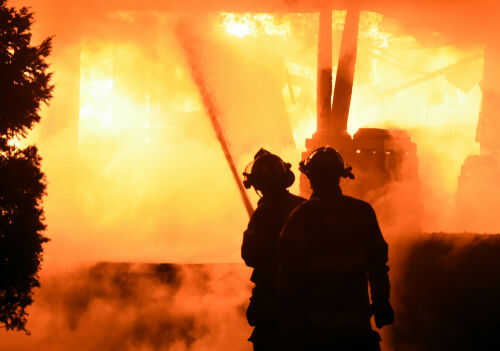
When North Wales fire chiefs declared a major incident on Conwy Mountain, it was not an isolated drama but a textbook example of how a warming, drying climate is turning parts of the UK into occasional high-risk wildfire landscapes.
Key Points
- A large-scale wildfire near Sychnant Pass on Conwy Mountain in North Wales triggered a formal major incident declaration and evacuations of nearby residents.
- The blaze erupted during an intense heatwave, in conditions firefighters warned could allow the fire to spread and threaten homes, roads, and local infrastructure.
- UK wildfire risk is intermittent but severe, clustering in dry, hot years when accumulated vegetation fuel meets prolonged drought.
- Emergency services increasingly rely on “major incident” protocols to coordinate multi-agency responses as wildfire seasons become more complex under climate change.
Conwy Mountain: What Happened and Why It Was Declared a Major Incident
The Conwy Mountain fire began in the early hours near Sychnant Pass, a steep, heathery ridge above the coastal settlements of Capelulo and the wider Conwy area. Residents reported waking to the smell of smoke and visible flames moving across the slope, with one local describing the mountain as “stripped bare” by the end of the day as vegetation burned away to rock. North Wales Fire and Rescue Service, facing fast-moving flames in difficult terrain and strong winds carrying smoke over a wide area, formally declared a major incident as crews moved in with pumps, hose lines, and specialist wildfire tactics.
Declaring a major incident is not simply rhetorical. In UK emergency planning, it is a specific procedural step that unlocks structured, multi-agency coordination: local councils, police, health services, and sometimes military assistance are brought under a unified command, evacuation and rest centres are organized, and public messaging shifts from routine advisories to clear, directive communications. In this case, residents along Fairy Glen Road and parts of Capelulo were ordered to leave their homes as a precaution, with rest centres opened to accommodate evacuees while firefighters tried to hold the fire at natural breaks and man-made containment lines.
By the time Sky News and BBC reports framed the situation as a “large-scale wildfire,” crews were already confronting classic UK upland fire behaviour: surface flames racing through dry grass and heather, spot fires ignited by windblown embers, and the risk of smouldering peat that can carry heat underground and re-emerge days later. Strong winds meant smoke travelled far beyond the immediate valley, and social updates from the fire service warned that burning could be smelled at considerable distance. Given the proximity of homes, narrow access roads, and a popular walking area, the threshold for declaring a major incident was clearly met.
Why North Wales Is Vulnerable: Terrain, Vegetation, and Human Use
To understand why a fire on Conwy Mountain escalated so quickly, you need to look at the landscape. North Wales, like the South Pennines and other upland regions, carries a mosaic of heathland, moorland, and rough grassland — vegetation types that, when dry, burn readily and can transmit fire rapidly upslope. Research on the South Pennines moorlands logged roughly 388 recorded moorland fires between 2000 and 2008, with higher densities close to populated southern areas. The same pattern holds in north-western Wales: the most attractive views and walking routes are often on the same slopes where fuels accumulate and access for firefighting vehicles is limited.
Heathlands and moorlands pose a particular management challenge. They are ecologically valuable, support tourism, and in some cases are deliberately burned in controlled rotations for habitat and grazing purposes. Yet the very structure of these landscapes — continuous flammable cover, interwoven with peat soils and occasional conifer or broadleaf stands — gives fires room to run once ignited. The Conwy Mountain blaze illustrates this: once the fire took hold above Sychnant Pass, residents watching from below saw flames move along the slope and across the ridge, not in isolated patches but as a line of burning vegetation.
Human activity is the other half of the risk equation. Most UK wildfires are ignited by people, through discarded cigarettes, campfires, barbecues, machinery sparks or intentional fire-setting. During heatwaves, local habit — a walk with a disposable barbecue, an impromptu campfire, a cigarette thrown from a car — intersects with the most receptive fuels. The North Wales Fire and Rescue Service’s own WildfireWise campaign highlights exactly these behaviours, encouraging residents and visitors to avoid open flames and report any smoke sightings early. In the Conwy incident, prompt calls from locals in the pre-dawn hours gave firefighters a critical time advantage, even though conditions later pushed the fire into major incident territory.
Wildfires in the UK: Intermittent but Increasingly Serious
Despite dramatic images from events like Conwy Mountain, wildfires in the UK remain intermittent rather than annual, quasi-seasonal phenomena. Comprehensive policy analysis shows that severe wildfire years cluster in specific periods: 1976, 2003, 2006, and 2011 stand out, with the 2011 Swinley Forest fire acting as a catalyst for formal wildfire policy and national awareness. These years share a similar pattern — preceding wet seasons allow vegetation to flourish, followed by prolonged dry, hot conditions that desiccate fuels and lower ignition thresholds.
Climate risk assessments for the UK now treat wildfires as a “growing but still episodic” hazard. The majority of incidents occur in grasslands and broadleaved woodlands, yet the largest burned areas and the most complex firefighting challenges emerge in heathlands, moorlands and peat-rich soils. Scottish incident data shows that larger wildfire events vary markedly year to year, from around 50 big incidents in a relatively quiet 2020 to more than 130 in an active 2010, reinforcing the sense of peaks rather than a steady trend.
However, the underlying fire weather — combinations of temperature, humidity, wind and fuel dryness — is shifting. Global research indicates that the frequency and severity of fire-favourable weather has increased in recent decades and is projected to rise further with each additional increment of warming. UK-specific work echoes this, warning that rising temperatures, longer dry spells and altered vegetation patterns will create more windows where large, fast-moving fires like the one on Conwy Mountain are possible. In that context, each major incident is less an anomaly and more a glimpse of a future in which fire services and local communities must be ready for periodic, high-impact events.
The Role of Major Incident Protocols and Evolving Fire Service Practice
One notable shift since the early 2010s has been the more frequent use of “major incident” declarations in response to wildfires. Historically, UK fire services framed large vegetation fires as extended incidents handled largely within their own operational silos. Following Swinley Forest and subsequent policy reviews, wildfire was recognized as a distinct risk requiring dedicated training, cross-agency planning, and national coordination mechanisms.
Declaring a major incident around Sychnant Pass triggered exactly those mechanisms. North Wales Fire and Rescue Service brought in mutual aid crews, coordinated with local councils on rest centres and road closures, and used public channels to give clear instructions to residents and businesses. Drone imagery, used by national broadcasters, showed firefighters working along ridgelines and containment points, illustrating how modern wildfire practice blends traditional ground crews with aerial situational awareness.
This procedural evolution matters because it directly affects how quickly vulnerable people are protected. In the Conwy case, BBC reporting noted that 36 homes were at risk or directly affected in the early stages, with the fire expected to spread under ongoing heatwave conditions. On a hot, windy day with limited access routes, waiting to see whether the fire would “self-extinguish” would have been irresponsible; the major incident declaration reflected a modern appreciation of how quickly conditions can deteriorate. As climate change pushes UK temperatures towards the extremes already seen in continental Europe, fire services are explicit that they may face triage decisions about which fires and which properties to prioritize.
Mapping Risk: Where Future UK Wildfires Are Most Likely
For residents and policymakers, the obvious question after an event like Conwy Mountain is: where else is this likely to happen? Detailed spatial analyses from upland regions give some guidance. The South Pennines study, for example, produced a fire risk map showing clusters of incidents around urban fringes and popular access points — precisely the zone where human ignition sources and flammable vegetation overlap. National reviews of wildfire in the UK highlight similar hotspots: upland moors in northern England, heathlands in southern England, parts of the Highlands and west coast in Scotland, and the heathery, gorse-rich slopes of Wales.
Risk mapping does not mean every hot, dry day will bring catastrophe, nor that remote residents must live in constant fear. It does mean that local authorities can identify areas where simple measures — clear signage, seasonal fire bans, maintained access tracks, community education and targeted patrols — offer outsized risk reduction. In North Wales, campaigns like WildfireWise are one part of that; fire services also work with landowners and conservation bodies to manage fuel loads and plan access routes that balance ecological sensitivity with firefighting practicality.
For the public, understanding that the UK’s wildfire problem is concentrated rather than universal is important. Someone living in a dense urban core faces different risks than a family on the edge of a moor. A resident of Capelulo, watching flames on Conwy Mountain, learns quickly that the pleasant scrub and heather behind the garden fence is not just scenery; under certain conditions, it is a fire regime.
Emergency services in North Wales declared a major incident yesterday, following a large wildfire near Sychnant Pass on Conwy Mountain.
Catch up on more of this morning's headlines here: https://t.co/YmTirvYbjR pic.twitter.com/bl0vhbfHH2— ITV Wales News (@ITVWales) July 13, 2026
Living With Intermittent Fire: Practical Lessons from Conwy Mountain
What, then, are the practical lessons from the Conwy Mountain major incident for communities across the UK? First, early reporting matters. Locals who called the fire service at first sight or smell of smoke likely bought precious time. Second, heed evacuation orders promptly. Residents in the exclusion zone near Fairy Glen Road were asked to leave not because their homes were doomed, but because concentrating people in rest centres allows responders to protect life without trying to defend every property simultaneously.
Third, treat heatwaves as compound events. The same conditions that fuel wildfires — high temperatures, low humidity, stressed vegetation — also strain health systems and critical infrastructure. In the weeks around the North Wales fire, broadcasters were already discussing thousands of excess heat-related deaths and urging people to take basic precautions. Thinking of wildfire not as a separate hazard but as another expression of extreme heat helps align community response: stay hydrated, avoid unnecessary travel through high-risk landscapes, and follow fire safety guidance carefully.
Finally, recognize that while UK wildfire risk is growing, it remains manageable with sensible preparation and modern emergency practice. The Conwy Mountain fire was serious enough to merit a major incident declaration, evacuations, and national coverage; it was also met with coordinated action that prevented more severe outcomes. That combination — higher stakes, better preparedness — is likely to define the UK’s relationship with wildfire in the coming decades.
Sources:
independent.co.uk, facebook.com, gbnews.com, uk.news.yahoo.com, northwalespioneer.co.uk, northwalesfire.gov.wales, research.manchester.ac.uk, pmc.ncbi.nlm.nih.gov, ourworldindata.org, bbc.com, nationalemergenciestrust.org.uk, agupubs.onlinelibrary.wiley.com