

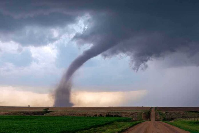
A funnel cloud spun over northern Delaware as severe storms damaged parts of New Castle County, and officials worked to confirm if a tornado touched down.
Story Highlights
- Television outlets reported a tornado confirmation in New Castle County tied to afternoon storms.
- Damage included a torn-down hotel sign, downed trees, and broken windows in the Newark area.
- Radar showed tight rotation that supported a tornado warning and follow-up investigation.
- National Weather Service records explain how tornadoes are confirmed and logged.
What Officials And Broadcasters Reported
Local television coverage stated that the National Weather Service confirmed a tornado touchdown in New Castle County during a late-day storm window. Reporters highlighted a narrow area of intense damage, which is common with weak to moderate tornadoes. They described a large hotel sign torn from its frame, trees on cars and buildings, and broken windows and siding around the Newark area. Those details match what viewers expect when a rotating storm carves a short path through a crowded corridor.
Storm chasers and radar analysts pointed to a tight “couplet” of inbound and outbound winds near Wilmington and New Castle County as the storms moved through. That couplet is a red-next-to-green signature on velocity radar. Meteorologists use that sign of rotation to issue tornado warnings and to direct follow-up checks on the ground. The reported rotation lined up with the time and place of the damage that television stations later showed on air.
How Tornadoes Get Confirmed And Recorded
The National Weather Service collects storm data from many sources, then builds an official record. Local offices document the location, time, strength, and impacts of events using damage surveys, reports from emergency managers and law enforcement, trained spotters, and media accounts. Staff weigh whether damage patterns match a twisting wind path or straight-line gusts. When evidence supports a tornado, they assign an Enhanced Fujita rating and add the event to national records.
The National Centers for Environmental Information maintain the public Storm Events Database, which stores these local reports. Users can search by county, date, and event type to find entries such as tornadoes, hail, and thunderstorm winds. In New Castle County, the database shows multiple severe weather events in 2023 and confirms at least one tornado that year. That system exists so citizens, insurers, and local leaders can review what happened and plan for future risk.
Damage Details And Why They Matter
Witness accounts and news clips described a heavy hotel sign knocked onto two vehicles, along with scattered tree and building damage. That pattern often shows a short track with sharp changes in wind direction. Such signals push investigators to check more closely for a tornado path rather than straight-line winds. A focused swath with snapped limbs and twisted debris often points to rotation, while a broad fan of damage suggests a downburst or squall line gust.
Emergency managers and National Weather Service staff look for clues at each building. They compare damage to known indicators, like roof loss or wall collapse, and then estimate wind speeds. That process sets the final rating and helps explain why one block looks fine while the next block is hit hard. It also shapes how communities design building codes and where they place sirens, shelters, and other protections for the next storm.
Why The Date And Place Details Can Get Confusing
Storm days often bring many warnings, funnels, and damage reports across a metro area within hours. Television coverage can blend scenes from different towns and times when producers race to air. The Storm Events Database sorts events by county or forecast zone, which helps, but it also means a county entry can feel broad to viewers looking for a street-level match. When video of a funnel cloud surfaces, analysts still need ground clues to tie that video to a specific, confirmed tornado path.
The National Weather Service has cancelled Tornado Watch 705 for New Jersey, southeastern Pennsylvania and Delaware. The tornado threat is over, NWS Mount Holly said at 6:15 p.m. EST.
Flash flood warnings remain this evening in parts of New Jersey — Monmouth and Ocean counties…
— Alex Reed (@Trader_GG_USA) November 13, 2026
The bottom line is simple. Radar rotation explains why a warning went out. Damage on the ground decides whether a tornado is confirmed and how strong it was. National Weather Service guidance directs staff to survey damage quickly and to use many sources to build the official record. That system is not perfect, but it gives families, first responders, and small businesses a common record to trust when they rebuild and prepare for the next storm.